

Spanning 630 miles (1014 km), the South West Coast Path covers the full coastline of England’s South West peninsula, from Minehead in Somerset to Poole Harbour in Dorset. With more than 115,000ft of ascent and descent, completing it is equivalent to climbing Snowdon 48 times, Ben Nevis 26 times and Everest 4 times!
During a trip through Devon, we took the opportunity to check off a section of the coast path as we hiked from Kingswear village to the charming fishing town of Brixham. This 10.8 mile (17.5km) section of the South West Coast Path makes for a strenuous but rewarding day of hiking, and ends in a bustling, well-connected town where there’s lots to see and do. Read on for everything you need to know about hiking this section of the coast.
Table of Contents
Travelling to and from the hike
This section of the South West Coast Path begins on the River Dart in Kingswear, a small village that is well-connected by bus routes to surrounding towns such as Brixham, Paignton and Totnes. For those arriving by car, there are 290 car parking spaces available at Darthaven Marina (charges apply), though we recommend arriving by public transport for this point-to-point route. If you do drive into Kingswear for this hike, buses from Brixham Town Square will bring you back into Kingswear in around 15 minutes.
Our OS Map route, which you can download on our Kingswear to Brixham walk page, begins at the Banjo bus stop just a few minutes’ walk from the coast path. Brixham, the end point of this route, is equally easily accessible by bus and you can take buses in multiple directions from the Town Square stops. Alternatively, there are many wonderful accommodation options in Brixham if you’re planning on staying in the town – you’ll find our top recommendations for post-hike accommodation below.
Following the route
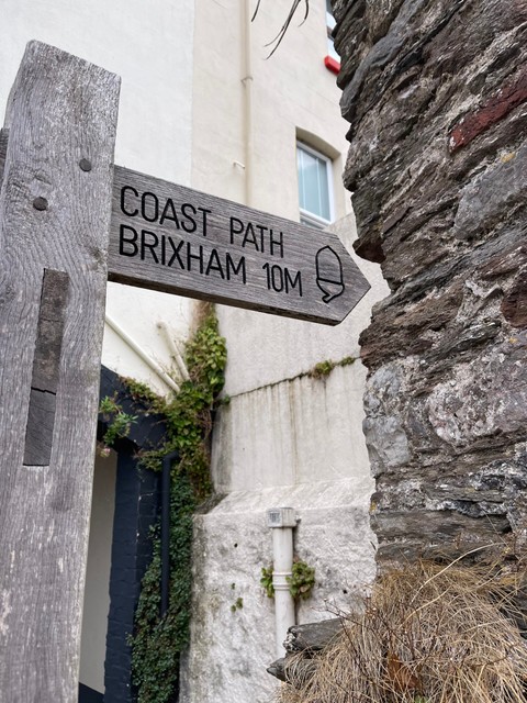
Just a few minutes’ walk from the start point of our route, you’ll spot your first signpost for the South West Coast Path at Alma Steps. Wooden signs guide you along the length of the South West Coast Path so it’s difficult to lose your way – look out for the acorn denoting a national trail. Most of these signs also let you know how many miles you have to walk to reach the next town or point of interest, while others are posts with a simple acorn and arrow to keep you on track when a path splits. It’s important to stick to the paths so as not to interfere with the surrounding land, as well as for your own safety, especially during narrow points along the cliff edge.

Download our OS Map route to your phone before you begin your hike, so you can follow the route along the way.
What to pack
As with any hike in England, you’ll find yourself at the whim of the weather! This is especially true on this route as you’ll hike along rugged coastal paths, with little shelter from the elements. Make sure you keep an eye on the weather for the day of your hike and pack accordingly. Rain jackets are a must in inclement weather, while hats and sun cream are especially important during the Summer months or on sunnier days. There are very few sections of shade along this route, plus with a cool sea breeze you might not feel yourself getting sunburnt. Take precautions from the start to avoid discomfort further along the route, where there are few facility stops.
Speaking of facilities, there are only 2 opportunities to stop at a cafe along this route (more on these below). Therefore it’s important to pack enough water, food and snacks to keep you going as you hike. Check out our recommended list of Top hiking snacks for inspiration!
Think grab-and-go snacks that require no preparation, like cereal bars, and make sure you pack something more substantial like a sandwich to give yourself a bigger fuel boost later in the day. Make sure you have enough water bottles too, as you can re-fill these at the 2 cafes en route. We have these foldable Salomon water bottles that don’t take up much space in your backpack and fold down into a small shape when empty.
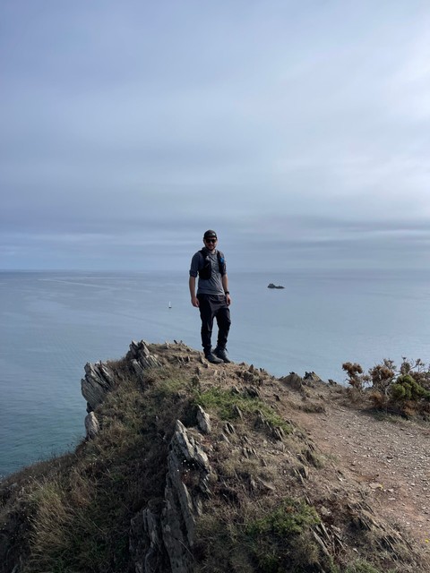
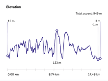
You won’t need to bring a paper map on this hike as the coast path is very easy to follow, and the signposts are relatively frequent. If you download our OS Map route onto your phone, you’ll be able to see how many kilometres you have left to go, as well as looking at the elevation profile to know when your next big climb is (spoiler alert – it’s always just a few minutes away!). Check out the route on our Kingswear to Brixham walk page.
We recommend a light day back pack to carry your gear for the day, as you won’t need to bring too many items with you. You may want to consider bringing hiking poles for this route as there are many ascents, descents and uneven pathways. It’s also imperative you wear sturdy, comfortable hiking shoes as the hike will test your feet and legs! Which brings us to…
Terrain and elevation
This section of the South West Coast Path has 946 metres of elevation gain over 10.8 miles (17.5km), with many ascents and descents, each of which are incredibly steep. You’ll feel your calves and thighs burning as you head up each climb, and it’s important to take it slow and steady to conserve your energy along the route. Fortunately, taking a pause during a climb just gives you more opportunity to take a look around at the stunning coastal views! The sharp ascents and descents, paired with rugged, narrow paths, make up the majority of this route so it’s important not to go into it lightly.

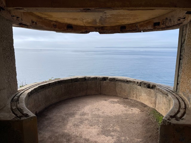
The terrain along the way is varied, with a mix of grass, dirt path, and some stretches of pavement walking as you leave or approach the populated places at either end of the route. In parts, there are tree roots or rocks protruding from the narrow cliffside paths, and there are some steep steps to climb up or down. At the old Brownstone Battery, for example, you’ll head down the cliffs along an old set of stairs that were used to access a gun base during WWII.
Cafes and facilities
As we’ve mentioned, facilities are scarce on this route – there are only 2 places to stop for food and toilets. The first is just before the 3.7 mile (6km) mark, around Pudcombe Cove, where you’ll have the opportunity to take a 10 minute detour off the coast path and head up through a gate into Coleton Fishacre. While it might not seem long into the route, the strenuous climbs up and down to reach this point mean you might find yourself in need of an early refuel!
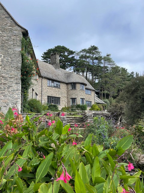
The walk to the cafe is uphill, but we highly recommend a stop here for the chance to refill water bottles, use the toilet facilities, and enjoy a cuppa and a sweet treat to keep you going – definitely try the blueberry Bakewell slice! Dogs are welcome on lead throughout the gardens, and both inside the cafe and outside on the sun terrace here.
Coleton Fishacre is a National Trust property, but you won’t need a membership to head through the small gate on the coast path. Enjoy walking through the spectacular gardens with towering bamboo and palm trees, past peaceful ponds and along pristine flowerbeds bursting with colour, as you make your way back onto the coast path.
The second and final stop is at Berry Head National Nature Reserve, just 1.2 miles (2km) before the end point of this walk. If you’re really desperate for snacks (or the loo!) and can’t wait until Brixham, the Guardhouse Cafe is just a 3 minute walk off the South West Coast Path and serves locally-made food, including cakes and cream teas. Dogs are welcome inside the cafe but must be kept on lead.
Once you reach Brixham town, you’re spoilt for choice with eateries to refuel after your hike – head to our dedicated Brixham blog post for a few recommendations.
Sight-seeing
While this hike follows a relatively small sliver of the South West Coast Path, there are many points of interest and fantastic viewpoints along the way, not to mention the opportunity to spot wild dolphins and seals swimming in the waters all around the coast!
Heading around the coast away from Kingswear village, around 2.1 miles (3.5km) into this route you’ll arrive at Brownstone Battery – one of the few remaining WWII coastal defence positions. Today it’s home to Froward Point, a coastwatch lookout station manned by volunteers, with a visitors centre highlighting both the volunteers’ role here and the Battery’s history. It’s worth a brief stop here for the opportunity to head inside the lookout and chat with the volunteer on duty, and for uninterrupted views out to sea from one of the surviving gun bases.

As we’ve mentioned in the Cafes and Facilities section, it’s worth a short 10 minute detour off the coast path to visit the cafe and toilets at Coleton Fishacre, whilst admiring the beautiful variety of plants and flowers as you make your way up the hillside. This National Trust property is home to a 1920s Arts and Crafts style house, and while you might not have time to head inside during your hike, the gardens make for a peaceful place to rest your feet overlooking the exotic plants and wildflowers below.
Back on the path below, at a viewpoint overlooking Pudcombe Cove you’ll spot a tidal pool that was built for exclusive use of the family at Coleton Fishacre in the 1920s. Coastal erosion has since destroyed the steep path down to the Cove, where the family had also built a shelter, sun bathing area and yacht landing platform.
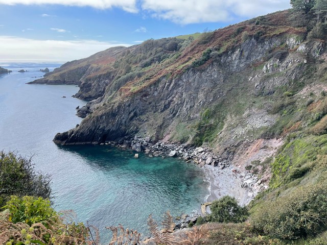
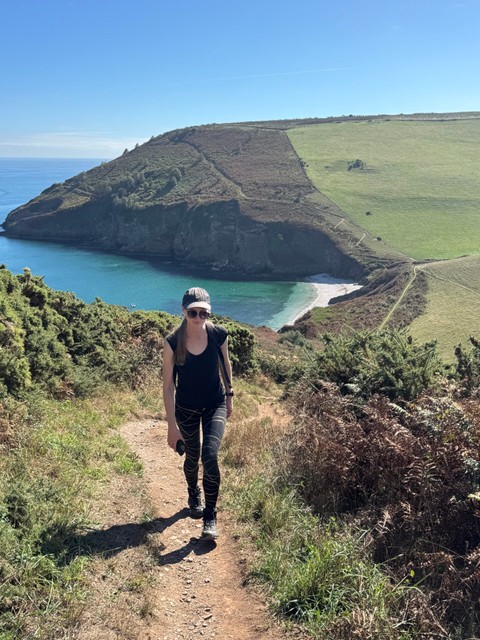
Along the coast path, there are many beautiful beaches tucked away along the coastline where you can stop for a rest or a dip in the sea. Around the halfway point, Scabbacombe Sands is a sheltered rest stop on a shingle and sand beach. There are lots of flat stones here shaped by the waves, perfect for stone skimming!
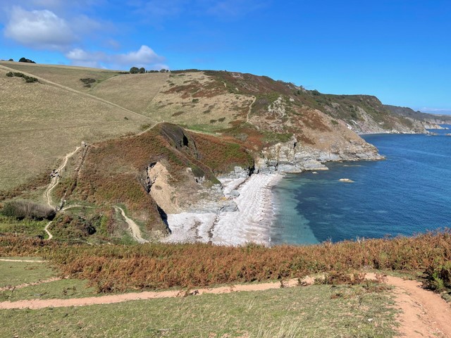
Further along, around 6.2 miles (10km) in, Man Sands is another chance to sit and rest awhile before you head up the steep ascent before you. This beach is a particularly tranquil spot, as the nearest parking is a 30 minute walk away and there are no facilities here. It’s the perfect beach to enjoy some lunch and sit on the sand or paddle in the water, with a view up the steep, winding ascent you’ll be tackling on the next stage of your hike!
In the last few kilometres of your hike, having already been spoilt with breathtaking coastal views every step of the way, you’ll arrive in Berry Head National Nature Reserve. This stunning headland nature reserve is surrounded by the sea on 3 sides and is home to a variety of wildlife, so it’s no surprise that the area is classified as both a National Nature Reserve and a Special Site of Scientific Interest (SSSI). The wildlife here includes the endangered Greater Horseshoe bat located in the caves, and a colony of guillemots on the cliffs below the Southern Fort which is one of the largest colonies on England’s south coast.
Berry Head was chosen as a strategic point for the defence of the coastline during the Napoleonic Wars, and again in WWII. The Napoleonic defences here are some of the best-preserved examples in Britain, and include 2 forts and several gun batteries.
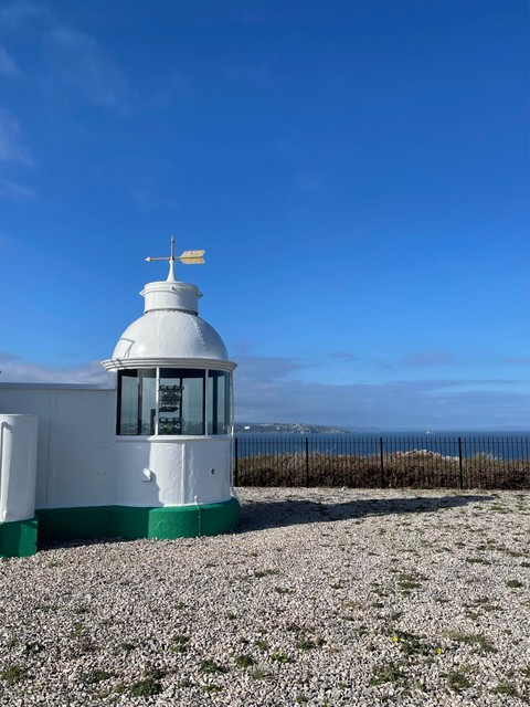
Aside from the historical importance and rare wildlife, Berry Head is also simply a gorgeous place to walk, with coastal views across Torbay and beyond from the lighthouse. It’s worth walking the 10 minute detour off the coast path to the cliff edge here to see this sweet lighthouse, as its short tower is quite unusual – when the lighthouse was constructed in 1906, it didn’t require a large tower as the headland gave the beacon sufficient elevation.
Arriving in Brixham, the end point of this hike, there are so many things to see and do that we’ve written a dedicated blog post about how to spend your time here. If your legs will carry you for a little longer as you arrive into Brixham, head along the Breakwater for uninterrupted views back across Brixham Marina and towards the colourful Brixham Harbour. You may also spot seals basking in the shallows along the water’s edge here! If you fancy a quick dip to cool off on a hot day, the adjacent Breakwater Beach is the perfect place to relax on the pebbles or dip your aching feet in the sea.
Head to our Brixham blog post to find our top recommendations for fresh seafood restaurants, seasonal activities, and more ideas for things to do while you’re in the area.
Where to stay in Brixham
If you’re looking to rest overnight at Brixham, here are our top recommendations for post-hike accommodation:
Sampford Harbour Side Guest House. Situated on King Street, just a few minutes’ walk from Brixham Harbour, Sampford Guest House offers visitors a comfortable stay within an historic 18th-century, listed fisherman’s house. Each room has its own private bathroom, and there are stunning views out to sea from your window! There are a variety of home-cooked breakfast options available to set you up for your day, whether you’re strolling around town or heading further along the coast path, and the guest house is dog-friendly. Find out more and book your stay at Sampford Guest House here.
Mariners Cottage. This charming cottage right on the harbour is the closest you’ll get to the sea! Mariners Cottage overlooks boats in the harbour from the front of the property, and is ideally situated for exploring the town. There are 2 bedrooms and a cosy living room, with characterful wooden beams on the ceilings and a stone fireplace housing a large TV for relaxing at the end of your hike. The cottage has a fully-equipped kitchen and washing machine, plus a spa bath, and is dog-friendly so your four-legged friends can join you! It’s the perfect cottage for a cosy, relaxing stay. Find out more and book your stay at Mariners Cottage here.
Berry Head Hotel. Located just outside Berry Head National Nature Reserve, Berry Head Hotel sits within 6 acres of grounds and provides stunning clifftop views along the coastline. Each room, from their single rooms up to their family rooms, have an ensuite bathroom and complimentary toiletries, as well as tea and coffee making facilities. Free parking is included on site, and the hotel has its own restaurant and bar if you don’t fancy walking further into Brixham to eat. The hotel even has its own heated indoor pool for a relaxing post-hike swim. When you do want to visit the town, Brixham Harbour is just 20 minutes’ walk from the hotel. Find out more and book your stay at Berry Head Hotel here.
Points to consider
A few little things to help you make the most of your hike:
This route is a strenuous one. The rugged climbs and exposure to the elements along the coastal path make for a tiring but rewarding day of hiking. Our OS Map route states 4.5 hours to complete this hike, though expect to take closer to 6 hours to allow for rest stops and deviations from the path to visit the limited facilities.
Pack lots of water and food. We recommend taking plenty of water, which you can refill at Coleton Fishacre or the Guardhouse Cafe, plus lots of snacks to keep you going while you walk as those are the only 2 cafes en route. Plus, there’s nothing better than a lunch stop on a beach to rest a while and enjoy the sea views.
The path is very exposed. While there are lots of picturesque places along the way to sit and admire the coastal views, very few are in shade, and you’ll find yourself exposed to the elements as you walk. Take note of our What to pack section and bring appropriate items for the weather and time of year, such as sun hats or waterproof clothing.
Plan your onward travel. Make sure you plan how you’re ending your hike in Brixham, whether it’s booking a place to stay in advance, or looking at local bus routes and times. During Summer, Brixham becomes a lot busier with tourists heading to the coast, so it’s worth booking your accommodation before you arrive in town. On the weekends, buses are less frequent and it’s good to know how long you’ll have to wait for the next one – even a quick glance at Google Maps will help you plan your onward journey so you don’t get stranded.
Take care with dogs. If your dog is fit and able enough to walk this route with you, it’s vital to ensure you carry enough water for both you and your dog – especially in hot weather. You’ll find sheep grazing along parts of this route, so make sure you keep your dogs under close control and give the animals space. The only dog waste bins are in Kingswear and Brixham at either end of the route, or at the cafes. If you do need to carry bags for a short while, we know just the item to bring with you! As the route follows the cliff edge, use your best judgement and put your dogs on lead when necessary, for their safety and yours as well as those around you.


We are Chris+Suze


